Background Maps
The ability to view maps (or other imagery) as a backdrop to your spatial data is activated by clicking Add a background map on the Data Inspector toolbar:

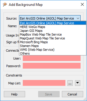
The background map dialog lets the user add a background map from a web service. Some of these - such as ArcGIS Online - require an existing account:
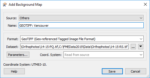
You can also use an existing dataset (of any FME-supported format) as a backdrop, by selecting Others and filling in the Format and Dataset:
| TIP |
| Keep in mind you can select multiple datasets of the same format when adding a background map (or any reader). In the image above, the user is adding many orthophoto raster images. |
Coordinate Systems
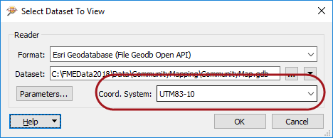
Source data must be referenced with a valid coordinate system to view it with a background map. If the coordinate system is not recorded in the dataset itself, you may enter it into a field when opening the dataset:
FME can display the source data against a background map, even when there are several source datasets of differing coordinate systems. FME does this by reprojecting the data to the coordinate system used by the background map. Therefore it's recommended that you turn off the background maps when you want to inspect the data in its original form.
| FME Lizard says... |
| You can adjust the symbology and display order of the background map in the Display Control window, just as you can for any normal dataset. |