
Page 47 - TransportationPlanUsetsGuide
P. 47
Roadway Congestion
Current Congestion
Traffic congestion is often represented as a ratio of the motor vehicle volume (or demand) to roadway capacity. De-
mand-to-capacity (D/C) ratios were estimated for the 2010 PM peak hour (between 4:00-6:00 PM) using the Washing-
ton County travel demand model. This model includes most collectors, arterials, and highways in Washington County.
Locations in Washington County where peak period minimum performance standards are likely to be exceeded are
listed below.
• I-5 (various segments between OR 217 and I-405)
• OR 217 (various segments between US 26 and I-5)
• OR 99W (south of OR 217)
• TV Highway (east of 185th Avenue)
• Durham Road (west of Boones Ferry Road)
• Greenburg Road
• Scholls Ferry Road (west of OR 217)
• Boones Ferry Road (between Bridgeport Village and east of Tualatin Road and in the vicinity of 95th Ave/
Commerce Circle)
• Walker Road (various segments between Cedar Hills Boulevard and Amberglen Parkway)
• Roy Rogers Road (south of Scholls Ferry Road)
• Cornell Road (west of Saltzman, west of 185th, and west of Brookwood)
• West Union Road (west of 185th)
• Evergreen Parkway (west of 185th and west of Imbrie)
• Tualatin-Sherwood Road
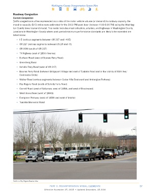
Traffic on Roy Rogers Road at 99w
PART 3: TRANSPORTATION MODAL ELEMENTS 37
Effective November 27, 2015 • Updated December, 15 2016