
Page 173 - TransportationPlanUsetsGuide
P. 173
RD
SELLERS BANKS RD RD
MOUNT AINDALE SHADYBROO KRD SCHOOL RD
DERSHA M RD JACKSON HELVETIA R D
GORDON RD GLENCOE WEST UNION RD User’s Guide
CLAPSHAW HILL RD Transportation System Plan
GREENVILLE RD RD PHILLIPS RD
KAN SAS
ROY RD
CITY
HILLSIDERD
RD
ZION CHURCH RD MEEK RD CORNELIUS PASS RD
RD 185TH AVE
KEMPER RD WREN RD KAISER Bicycle Element
VERBOORT RD RD E VERGREEN RD PKWY R OCK RD LAI DLAW RD
GALES CREEK RD
PURD IN RD CORNELIUS SCHEFFLIN AVE CREEK BLVD BLVD
RD SUSBAUER HOR NECKERRD 25TH TH EVERGREEN Bike Lane Inventory
THA TCHE R RD
MARTI N AVE BR OOKW OOD SHUTE 229 PK WY BETHANY SAL T Z M AN RD
BRONSON RD
RD
E ST MAIN ST 1ST AVE GRANT ST CORNELL RD
RD 4TH AVE BASELINE ST WALNUT ST MAIN ST AVE
RITCHEY 19TH AVE 10TH AVE OAK ST LOIS ST BASELINE RD
B ST BLVD
HWY ROCK RD 170TH AVE 1 58TH 1 JENKINS RD P ARK WA Y BARNES RD RD Existing Both Sides
CEDARHILLS
STRINGTOWN RD
JOHNSON ST
FERN HILL RD TONGUE LN HILLSBORO MINTER BRIDGE RD BRID GE RD DAVIS RD TUALATIN VALLEY HWY 160TH AVE 53RD D 6TH ST 5TH ST CANYON Existing One Side
R
209TH AVE
Shoulder Suitable
IOWA
ROOD ROSEDALE RD 198TH AVE BANY RD HART RD MURRAY BLVD ALLEN BLVD RD Both Sides
DENNEY RD
HILL
JOHNSON SCHO OLRD
\\Emcgis\nas\GISDATA\Workgroups\GISPlanning\TSP_2035\TSP_User_Guide\ActiveTransElement\TSP_UserGuide_11x17_BikeLanes.mxd
VALLEY RD RD RIGERT RD OLESON Shoulder Suitable
SCOGGINS
RD NI MBUS One Side
RIVER FARMINGTON RD N RD 175TH AVE WEIR RD A VE
UNGER RD
PATTONVALLEY RD
GASTON RD DIXON MILL RD GRABHOR DAVIES RD GREENB UR G RD OAK ST None or no facility.
BALD PEAK RD CLARK HILL RD BAR ROWS RD 121ST AVE BLV D Other Roads
LAURELWOOD RD
LAUREL RD SCHO LLSFERRY RD BULL MOUN TAIN RD PACIFIC HWY HALL Urban Area
GAA RDE ST
SPRING
ROY ROGERS RD BEEF B END RD DURHAM RD 72ND AVE County
HILL
RD
SCHO L LS
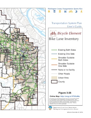
This map displays reference information that is not SHERWOOD RD TU ALATIN RD
adopted by Washington County ordinance. It is not to be SEIFFERT RD HERMAN RD TETON
considered as the official Washington County CIPOL ERD
Transportation System Plan. Please contact Washington AVE Figure 3-26
County Long Range Planning at (503) 846-3519 with any ELWERT RD EDY RD RD
questions regarding this map. TONQUIN FERRY Online Map: http://arcg.is/1PXZuMo
for, or be suitable for legal, engineering, or surveying purposes. Users
PINEST
SUNSET BLVD R D GRAH AMS FERRYRD BOONES 65TH AVE This product is for informational purposes and may not have been prepared
of this information should review or consult the primary data and information
CHAPMAN R D
BROOKMAN RD sources to ascertain the usability of the information. Care was taken
in the mapping but there are no warranties for this product. However,
1 inch represents 12,500 feet ELLIGSEN RD notification of any errors will be appreciated.
0 1.25 2.5
Department of Land Use & Transportation
Miles
Planning and Development Services Division
Effective: November 27, 2015