
Page 160 - TransportationPlanUsetsGuide
P. 160
date pedestrian and bicycle travel on state roads be a minimum of six feet wide. Perhaps the most significant and well-
developed pedestrian facility in rural Washington County is the Banks-Vernonia Trail, which extends 21 miles between
the namesake towns, and connects to Stub Stewart State Park. More rugged trails can be found at Henry Hagg Lake
and in the Tillamook State Forest.
Rural Pedestrian Activity Areas
Several locations in rural Washington County attract or generate a small number of localized walking trips. These
Rural Pedestrian Activity Areas include small villages with clusters of houses, businesses, or public uses like schools,
churches, and social halls. Also included are road segments that connect nearby urban area and major recreational
destinations such as regional parks and trails. Rural Pedestrian Activity Areas, mapped in the Pedestrian System Maps
in Figures 3-24 and 3-25, include:
• The Villages of Blooming, Buxton, Cherry Grove, Dilley, Farmington, Gales Creek, Glenwood, Greenville,
Groner, Helvetia, Kinton, Laurel, Laurelwood, Manning, Midway, Roy, Scholls, Verboort and West Union;
• The half-mile rural section of Highway 8 between
Hillsboro and Cornelius;
• The intersection of B Street, Highway 47, and adja-
cent multi-use trails south of Forest Grove;
• The area surrounding Farmington View School along
Highway 219 south of Hillsboro;
• Henry Hagg Lake County Park;
• L.L. Stub Stewart State Park, which includes multiple
trail crossings of Highway 47;
• Tualatin River National Wildlife Refuge, which strad-
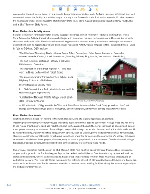
dles Highway 99W; and Helvetia Tavern on NW Helvetia Road
• A 2½ mile stretch of Highway 6 in the Tillamook State Forest between Gales Creek Campground and the Coast
Range Summit, featuring a parallel hiking trail, a scenic viewpoint, and several parking areas for other trails.
Rural Pedestrian Needs
Existing and future needs for walking in the rural area vary, and are largely dependent on context.
Installing walkway facilities in rural villages should be approached on a case-by-case basis. Village areas are not likely
to see major growth due to land use regulations, but traffic passing through them may increase as housing and employ-
ment grows in nearby urban areas. Some villages may exhibit enough pedestrian demand and automobile traffic conflict
to warrant building walkway facilities. Villages with schools, such as Groner, provide additional rationale for walkways.
However, construction of sidewalks or walkways could have unwanted impacts on the aesthetics of a village. Enhanced
crosswalks, which have fewer property impacts, may be more appropriate in some locations. Coordination with village
residents, business owners, and school officials is the best way to determine these needs.
Use of major recreation facilities such as Stub Stewart State Park and the Banks-Vernonia Trail are likely to increase
as population grows in the Portland region. Supportive pedestrian facilities on County roads may be needed, such as
enhanced crosswalks, where trails cross roads. Rural areas that are close to urban areas may have urban levels of
pedestrian demand. The most significant example is the half-mile stretch of Highway 8 between Hillsboro and Cornelius,
which includes bus service. Public comment revealed a need for better walking facilities along this stretch, especially at
the bridge over Dairy Creek.
140 PART 3: TRANSPORTATION MODAL ELEMENTS
Effective November 27, 2015 • Updated December, 15 2016