
Page 157 - TransportationPlanUsetsGuide
P. 157
Trails
Trails offer the greatest protection for pedestrians
from motorized traffic. Often associated with rec-
reational pursuits, trails also offer transportation
utility for short walking trips and longer bicycling
trips. Washington County has an ever-expanding
network of trails for walking, running, skating, bi-
cycling, and other forms of non-motorized human
travel. As of 2012, 69 miles of trails traversed the
County, including 36 miles in the urban area and
33 miles in the rural area. An additional 164 miles
of trails are in the planning stages Countywide.
Trail planning in Washington County occurs at
state, regional, and local levels. The State of
Oregon is involved through its stewardship of the
Banks-Vernonia Trail and nearby soft-surface trails
within Stub Stewart State Park and Tillamook
State Forest. Metro’s 2004 Regional Trails and
Greenways Vision established a strong conceptual
framework for trail development in the urban por-
tion of the County, which has since been embel-
lished by more specific trail plans from Tualatin
Hills Parks and Recreation District (THPRD) and
city jurisdictions. THPRD’s 2006 trail plan laid out
a bold vision for trails in the central part of Wash-
ington County, with regional trails further connect-
ed by community trails and on-road segments.
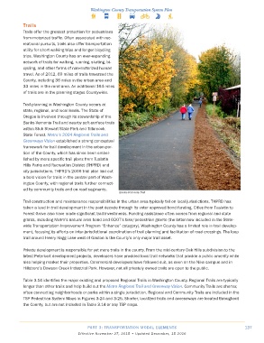
Banks-Vernonia Trail
Trail construction and maintenance responsibilities in the urban area typically fall on local jurisdictions. THPRD has
taken a lead in trail development in the past decade through its voter approved bond funding. Cities from Tualatin to
Forest Grove also have made significant trail investments. Funding assistance often comes from regional and state
grants, including Metro’s natural area bond and ODOT’s bike/pedestrian grants (the latter now included in the State-
wide Transportation Improvement Program “Enhance” category). Washington County has a limited role in trail develop-
ment, focusing its efforts on inter-jurisdictional coordination of trail planning and facilitation of road crossings. The loop
trail around Henry Hagg Lake west of Gaston is the County’s only major trail asset.
Private development is responsible for yet more trails in the county. From the mid-century Oak Hills subdivision to the
latest Peterkort development projects, developers have provided local trail networks that provide a public amenity while
also helping market their properties. Commercial developers have followed suit, as seen on the Nike campus and in
Hillsboro’s Dawson Creek Industrial Park. However, not all privately owned trails are open to the public.
Table 3.14 identifies the major existing and proposed Regional Trails in Washington County. Regional Trails are typically
longer than other trails and help build out the Metro Regional Trail and Greenway Vision. Community Trails are shorter,
often connecting neighborhoods or parks within a single jurisdiction. Regional and Community Trails are included in the
TSP Pedestrian System Maps in Figures 3-24 and 3-25. Shorter, localized trails and accessways are located throughout
the County, but are not included in Table 3.14 or any TSP maps.
PART 3: TRANSPORTATION MODAL ELEMENTS 137
Effective November 27, 2015 • Updated December, 15 2016