
Page 89 - TransportationPlanUsetsGuide
P. 89
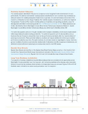
Roadway System Adequacy
                The roadway system identified in this plan is a component of an integrated multi-modal network of com-
                plete streets. The Arterial and Collector roadway system identified by the lane numbers map constitutes an
                adequate system for meeting anticipated travel needs. In general, the planned roadway component of the
                network is anticipated to meet Oregon Highway Plan mobility targets and standards, as well as the Regional
                Transportation Functional Plan interim mobility deficiency thresholds and operating standards, except for
                the segments identified in technical appendix Part 3 of Resolution and Order 14-113. These standards are
                further identified by interim Washington County Motor Vehicle Performance Standards (Table 3.1: Interim
                Washington County Motor Vehicle Performance Measures) within Goal 5 (Mobility) of this TSP.


                The technical appendix (part 2) to this plan includes a list of project candidates, which may be implemented
                within reasonably achievable funding constraints. The technical appendix (part 3) also identifies various
                locations that are forecast to exceed the motor vehicle performance standards after the implementation of
                planning improvements. These potential deficiency locations will require additional monitoring and system
                performance evaluation over time. For such locations, the ultimate decisions regarding the modes, functions,   ADOPTED TEXT
                general locations of solutions and potential development of alternative mobility measures and standards, are
                deferred to future refinement planning to be incorporated into the next TSP update.


                Special Area Streets
                Special Area Streets are identified on the Special Area Street Overlay Maps as well as in the County’s Com-
                munity Plans. Special Area Street design standards are included in the Washington County Uniform Road
                Improvement Design Standards. Figures 3-11 3-12 and 3-13 include the maps of Special Area Streets.

                Long Term Roadway Jurisdiction
                The Long Term Roadway Jurisdiction map identifies roadways that are considered to be appropriate under
                Washington County jurisdiction over the long term, with remaining roadways either staying under state juris-
                diction or becoming city roadways when currently unincorporated areas are annexed. Figures 3-14 and 3-15
                illustrate roads intended to be under county jurisdiction over the long term.


                                          PART 3: TRANSPORTATION MODAL ELEMENTS                                    73
                                     Effective November 27, 2015 • Updated December, 15 2016