
Page 93 - TransportationPlanUsetsGuide
P. 93
DR
LIBERTY BELL DR WALKER RD
DELTA
LISA
LISA ST REGATTA LN
E ESTUARY DR
DR
GEORG
E
CREEK DR PHILADELPHIA BUNKER OAK RD WATERLEAF LN 167THA V WATERLEAF Transportation System Plan
TOWN WAY
WAY
User’s Guide
WILLOW CASHEW W A Y 166TH AVE ST ESTUARY DR Roadway Element
LIBERTY BELL DR
AVE WHITLEY WAY WAY
ELE
STE
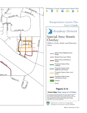
179TH PL BASELINE RD 163RD Special Area Streets
ALDERWOOD DR 178TH CORONA LN AVE Overlay:
MASON LN
LONGACRE ST AVE 175TH AVE GAGE LN 158TH AVE Willow Creek, Merlo and Elmonica
182ND 181ST JAY 176TH TER 160TH AVE Areas
HONEYWOOD DR AVE CT JAY ST
AVE JAY ST 170TH AVE JAY ST
185TH FRANCES ST 178TH AVE 172ND TER JENKINS RD Special Area Neighborhood
Route
MORSE LN MARTY LN Special Area Local Street
Special Area Commercial
Street
\\Emcgis\nas\GISDATA\Workgroups\GISPlanning\TSP_2035\TSP_User_Guide\RoadwayElement\TSP_UserGuide_11x17_SA_EM.mxd
PHEASANT LN MERLO DR Proposed Special Area
PLEASANTON LN Collector
BEAVER CT
BERKELEY LN Proposed Special Area
Neighborhood Route
Proposed Special Area Local
Street
MERLO RD
Proposed Special Area
Commercial Street
PHEASANT
EWEN
Corridor
M ERLO CT
187TH AVE DR AUGUSTA LN TC Street
DR
This map displays an unofficial representation of elements MERLO
AVE
adopted as part of Washington County Ordinance No. 783. It GA RAGE
is not to be considered as the official Washington County AVE C
H ATELAIN DR
186T H
Transportation System Plan. Please contact Washington Figure 3-12
LN
County Long Range Planning at (503) 846-3519 with any 178TH PL
LN
SANDRA
Online Map: http://arcg.is/1mVQq0y
SANDRA
questions regarding this map. 171S T This product is for informational purposes and may not have been prepared
JANNDR NIKS DR AVE for, or be suitable for legal, engineering, or surveying purposes. Users
of this information should review or consult the primary data and information
sources to ascertain the usability of the information. Care was taken
in the mapping but there are no warranties for this product. However,
1 inch represents 700 feet 178TH 175THAVE 170TH AVE notification of any errors will be appreciated.
JOHNSON ST
0 0.075 0.15
Miles Department of Land Use & Transportation
Planning and Development Services Division
Effective: November 27, 2015