
Page 103 - TransportationPlanUsetsGuide
P. 103
HELVETIA RD
RD
DERSHAM
CLAPSHAW HILL RD GREENVILLE RD PHILLIPS RD
AN RD GORDON RD RD RD WEST UNION RD
ROY RD
KERKM ZIONCHURCH RD GLENCOE SCHOOL Transportation System Plan
HILLSIDE RD
KA NSAS CITY RD
RD JACKSON MEEK RD CORNELIUS PASS RD 185TH AVE
KEMPER RD WREN RD SPRINGVILLE RD KAISER User’s Guide
GALES
VERBOORT RD E VERGREEN RD ROCK RD L AIDLAW RD
PURD IN RD CORNELIU S SCHEFFLIN 229TH CREEK BLV D BLVD THOMPSON RD
CREEK
RD
RD SUSBAUER RD HORNECKER RD 15TH AVE 25TH AVE AVE EVERGREEN PKWY SALTZMA Roadway Element
THATCHER RD
MARTIN CONNELL SUNRISE LN BROOKWOOD PKWY SHUTE RD BRONSON RD BETHANY N RD
D AVID HILL RD
MAIN ST BASELINE ST AVE 1ST AVE GRANT ST A VE 231ST AVE 173RD CORNELL RD Rural Road
MAIN ST
LEAHY R D
RIT CHEY RD 19TH AVE 4TH AVE 10TH AVE WALNUT ST BASELINERD BUTN ER RD Enhancement
OAK ST
B ST ELM ST BROOKW OOD LOIS ST 158TH AVE BARNES R D Study Corridors
ROCK RD 170TH AVE BLVD
ST RINGTOWN RD
JOHNSON ST
GOLF
JENKINS RD
AVE
RD CO URSE BRIDGE RD DAVIS RD ALEXANDER ST MI LLIKAN WA Y CEDAR HILLS CANYON RD Rural Road
FERN HILL TONGUE LN M INTER RD RIVER RD BL V D KINNAMAN RD 6TH ST BEAVERTON HILLSDALE HWY Enhancement Study
RD
BRIDGE CENTURY 209TH AVE 198TH AVE ROSA RD OAK ST 5TH ST Corridor
R OOD ROSEDAL E RD ALLEN BLVD Other Roads
IOWA
JOHNSON SCHOOL RD
DENNEY RD
155TH AVE BLVD RD
BANY RD MURRAY BLVD
HALL
SCOGGINS VAL LEY RD
HILL RD
BURKHALTER RD
RIGER T RD A VE OLESON Urban Area
FARMINGTON RD NI M BUS CASCA DE AV E 80TH AVE
\\Emcgis\nas\GISDATA\Workgroups\GISPlanning\TSP_2035\TSP_User_Guide\RoadwayElement\TSP_UserGuide_11x17_RURAL.mxd
UNGER RD GRABHOR
HILLSBORO
PAT TONVALLEY RD HWY 175TH AVE WEIR RD DAVIES RD GREENBU County
GASTON RD N RD OAK ST
DIXON MILL RD LARK HILL RD 121ST AVE RG RD AVE
BALD PEAK RD C BARR OWS RD WALNUT ST 72ND
LAURELWOOD R D
LAUREL RD SCHOLLS FERRY RD G AA R DE ST
SPRING
BONITA RD
HILL
BULL MOU NTAIN RD
ROY ROGERS RD 150TH AVE PACIFIC HWY DURHAM RD
RD
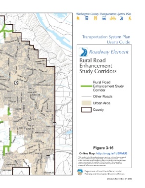
This map displays an unofficial representation of elements SCH O LLS SHERWOOD RD EL SNER RD
adopted as part of Washington County Ordinance No. 783. It TUALATIN RD
is not to be considered as the official Washington County SEIFFERT RD TETON
Transportation System Plan. Please contact Washington HERMAN RD Figure 3-16
County Long Range Planning at (503) 846-3519 with any TUALATIN SHERWOOD RD AVE SAGERT ST
ELWERT RD FERRY RD 65TH AVE This product is for informational purposes and may not have been prepared
questions regarding this map. EDY RD AVERY ST Online Map: http://arcg.is/1bSRMU8
for, or be suitable for legal, engineering, or surveying purposes. Users
sources to ascertain the usability of the information. Care was taken
in the mapping but there are no warranties for this product. However,
SUNSET BLVD TONQUIN of this information should review or consult the primary data and information
notification of any errors will be appreciated.
PINEST
1 inch represents 10,707 feet CHAPMAN RD RD GRAHAMS FERRY RD BOONES
0 1 2 D
Miles BROOKMAN R ELLIGSEN RD Department of Land Use & Transportation
Planning and Development Services Division
Effective: November 27, 2015