
Page 87 - Rural Tourism Report Washington County
P. 87
CHAPTER 4: RURAL TOURISM REGULATORY FRAMEWORK
Agriculture and Forest (AF-20) District Now that the AF-20 land use designation has been
(Section 344) modified to function similarly to EFU-designated
Although the land use designation suggests that the property, the range of Type I, II and III uses in the
minimum lot size in the AF-20 district is 20 acres, it two districts is virtually the same. See previous EFU
is in fact now 80 acres. Parcels currently designated district discussion for pertinent detail. The difference
AF-20 were previously designated as AF-5 or AF- is that AF-20 property may be deemed “marginal”
10 in the 1973 Washington County Comprehensive land, as discussed earlier under the “State and Re-
Framework Plan. Prior AF-5 and AF-10 designations gional Context” overview, but EFU land cannot be.
allowed for minimum five and ten-acre lots. So,
AF-20 districts often contain smaller parcels As previously noted, Table 4.1 summarizes the infor-
lawfully created prior to adoption of the 80-acre mation from the CDC for the EFU and AF-20 land use
minimum. The current AF-20 designation of such districts, and the other seven rural districts, EFC, AF-
land was intended to prevent further division of 10, AF-5, RR-5, R-COM, R-IND, and MAE including:
valuable agricultural land into small lots that might • The intent/purpose statement;
reduce the intensity of agricultural and forest • Rural tourism uses allowed by right (Type I);
activities and increase pressure on rural services and
infrastructure. As a result, a variety of parcel sizes • Rural tourism uses subject to conditions,
now exists in AF-20 districts throughout the County. including those subject to the impact test
(Type II);
AF-20 properties generally are found in the foothills • Rural tourism uses subject to required
above 350 foot elevations, with soil classifications findings and conditions (Type III); and
typically ranging from II through IV . Varying • Footnotes describing specific provisions for
65
intensities of farm and forest uses are present, but the impact test and required findings, and
agricultural activity is limited in areas with lower- aspects of Type II and III permits.
fertility soils, steep slopes, smaller parcel size due to
previous zoning, multiple ownership patterns, and/
or lack of sufficient water.
In Washington County, most AF-20 land is located in
or around the following areas:
• Chehalem Mountains
• Foothills northwest of Forest Grove
• Foothills north of Banks and North Plains
• Cooper Mountain
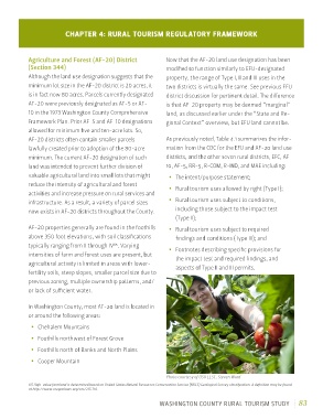
Photo courtesy of OSU EESC, Steven Ward
65 High-value farmland is determined based on United States Natural Resources Conservation Service (NRCS) Geological Survey classification. A definition may be found
at http://www.oregonlaws.org/ors/215.710.
WASHINGTON COUNTY RURAL TOURISM STUDY 83