
Page 43 - Wash Co First and Last Mile Background Report
P. 43
TECHNICAL MEMO #1
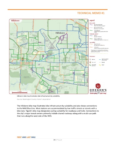
Hillsboro bike map illustrates bike infrastructure by suitability.
Source: Washington County Visitor’s Association
The Hillsboro bike map illustrates bike infrastructure by suitability and also shows connections
to the MAX Blue Line. Most stations are accommodated by low traffic streets or streets with a
bike lane. Tigard’s bike map designates cycling suitability for roadways and trails. Connections to
the city’s major transit centers primarily include shared roadways along with a multi-use path
that runs along the west side of the WES.
FIRST AND LAST MILE
34 | P a ge