
Page 35 - FY Annual Report 2017-18
P. 35
REGIONAL
COLLABORATION
the jurisdictions and organizations began reaching out
to property owners in the watershed. Which properties CEDAR MILL CREEK FLOOD
were affected? How often did the properties flood? How REMEDIATION COLLABORATIVE GOALS
severe was the flooding?
y Create an approach that minimizes or mitigates
“We held several open houses to talk to people one on flooding impacts while considering economic
one, and we’ve responded to a lot of emails and phone development, habitat value and quality of
calls,” Brown said. “This was important to us because life concerns.
we needed to get a sense of the scope of the problem.” y Develop a plan that can be phased.
People submitted photos of flooding and shared their y Identify funding sources.
experiences with eroding creek banks, falling trees
y Consider how multiple agencies’ regulations
and flood insurance. In spring 2018, the Collaborative can be addressed in a way that results in
Project Team responded with a list of potential policies, the greatest possible good for the public
programs and possible structural projects that could and for the ecosystem, i.e., a basin-wide
assessment approach.
be implemented to mitigate the flooding. The public
was asked to comment on the Collaborative website, Source: cedarmillcreek.org
Rocky Brown, Engineering Associate II www.cedarmillcreek.org.
“There isn’t one simple answer to managing this water- Enrollment in the National Flood Insurance Program
shed,” Brown said. “We’re going to have to continue to
Watershed management: work collaboratively, implementing coordinated, phased Community Rating System program is one strategy
COLLABORATIVE PARTNERS WORKING ON FLOOD REMEDIATION strategies to mitigate flooding.” under consideration. Communities—like Washington
County and the city of Beaverton—that demonstrate
commitment to flood mitigation and floodplain manage-
Rocky Brown, LUT Engineering Associate II, spent most In spring 2017, LUT and Clean Water Services (CWS) ment can apply to the program, which provides reduced
of FY 2017–18 talking to homeowners, businesses, successfully applied to have the Cedar Mill Creek Flood flood insurance rates for property owners in and adja-
organizations and concerned community members Remediation Collaborative (CMCFRC) watershed man- cent to floodplains.
about flood mitigation in the Cedar Mill/North Johnson agement project designated as an Oregon Solutions
Creek watershed. project by Gov. Kate Brown. The Oregon Solutions pro- “This could be a significant benefit,” Brown said. “We
gram brings jurisdictions, agencies, businesses, orga- realize that it doesn’t directly address flooding, but it
“When we have heavy rains, some properties in these nizations and community members together to address does provide people with some financial relief in the
areas experience significant flooding,” Brown said. “It’s mutual problems. near term.”
a serious problem without an easy answer.”
“The Oregon Solutions designation helped us bring Heading into FY 2018–19, agencies within the collab-
Cedar Mill and North Johnson creeks drain 5,300 acres everyone to the table,” said Andrew Singelakis, LUT orative signed a Declaration of Cooperation, which
in the West Hills into Beaverton Creek in the Tualatin Director. “We’ve created a dedicated partnership that solidifies the participating organizations’ commit-
Hills Nature Park. The creeks travel throughout the area includes engineers, land use planners, flood plain man- ment to manage and preserve the watershed while
—impacting homes, businesses and roads.
agers and natural resource experts to collaboratively mitigating flooding.
“Aside from those who live, work or drive the areas manage watershed and flood risks.” “The flooding in the watershed is the result of more
between Highway 26 and Beaverton Creek, many peo- In addition to LUT and CWS, the Collaborative includes intense rainfall events, decades of development, log-
ple aren’t aware of the water management issues we the city of Beaverton, Tualatin Hills Park & Recreation ging and more,” Brown said. “There’s a lot of history
have in this watershed,” Brown said. “But it’s definitely District, Federal Emergency Management Agency associated with this situation. Mitigating it will take time
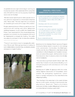
a community livability and environmental issue.” Cedar Mill Creek
(FEMA) and others. Together, representatives from all and study. But we’re making a good start.”
31 | Partnering for the Future LUT Annual Report FY 2017–18 LUT Annual Report FY 2017–18 Partnering for the Future | 32