UK Civil Hydrography Programme (CHP)
Information on past, present and future UK CHP survey plans, how to access and share hydrographic and seabed mapping data, and how to collaborate with the MCA
Overview: UK Civil Hydrography Programme
The Maritime & Coastguard Agency (MCA) has overall responsibility for the UK’s hydrographic obligations under the Safety of Life at Sea Convention (SOLAS). The MCA manages a multi-million-pound budget to systematically survey the waters around the UK. This programme is known as the “UK Civil Hydrography Programme” (UK CHP). Under the UK CHP, commercial contracts are let to ensure accurate hydrographic information is gathered for updating the nation’s nautical charts and publications.
The UK CHP prioritises areas of highest navigational safety risk and surveys and maps UK home waters - defined by the boundaries of the UK’s Exclusive Economic Zone, an area in excess of 720,000km2 - in order to keep our nation’s nautical charts and publications current, safe and fit for purpose.
The MCA makes extensive use of geographic information systems (GIS) to prioritise survey areas using a contemporary risk analysis methodology capable of reflecting the changing pressures of the maritime sector.
The hydrographic survey work commissioned for the UK CHP is undertaken by contractors, who gather and report seabed data using their own personnel, equipment and vessels.
The UK CHP workscope is divided into the following streams:
-
Routine Resurvey Programme - navigationally critical shallow water areas with mobile seabed;
-
Shallow Water surveys - predominantly 0m to 40m water depth; and
-
Medium Water surveys – 0m to 200m water depth.
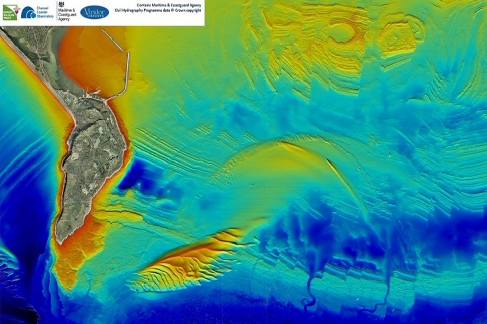
To support the requirements of the UK CHP, the MCA specifies state-of-the-art survey technologies including high resolution multibeam echosounders (MBES) and Real-Time Kinematic (RTK) Global Positioning Systems (GPS) to ensure accurate high-quality hydrographic information is gathered. Additionally, more focused work includes high-resolution wreck investigations, water column data collection and seabed grab sampling.
Prior to final data being accepted from contractors, it passes through a rigorous quality assurance process at the UK Hydrographic Office, where checks are made against items such as data density, interline consistency, geodetic parameters and tidal observations.
Once data has passed validation, it is archived to the UKHO’s bathymetric database ready for inclusion in their nautical charting products.
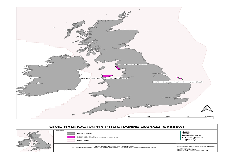
Where the MCA is surveying in 2021-22
The following graphics show the high priority areas that the MCA are surveying in 2021-22. These are the Shallow Water and Medium Water areas. Further surveys may be added, depending on available MCA budget, collaboration opportunities and survey capacity.
Civil Hydrography Programme 2021-22 – shallow water areas
Civil Hydrography Programme 2021-22 – medium water areas

Future surveys
The following graphic shows the high priority areas that the MCA are considering taking forward in future years, or that may be brought forward to the current year, depending on available MCA budget, collaborative opportunities and survey capacity.
Civil Hydrography Programme 2022-23 – shallow and medium water areas