“Itwas quite shoddilymade, and
in a very simplistic style,” he says.
With a lot of practice and through the
study of famousmaps, such as those
he found inold
NationalGeographic
magazines, Vargic soondeveloped a
muchmorecomplex stylewithwhich to
illustratehiselaborately imaginedmaps,
which visualiseeverything frompop
music and stereotypes to the internet.
So, just howdoes Vargic go about
creatinghismaps? “First, I need
tochoose the shape and layout of
themap,” he says. “Then I start the
actualmapmakingprocess. I draw the
preliminary outlines of the various
continents and landmasses, which
arebasedonmy general knowledge
about the subject, whether it’smusic,
literature, or sports. These landmasses
arepositionedbasedon their
relationshipwitheachother. Then,
I start the actual research.”
For hisMapof Literature, for
example, he researched thehistory of
various literary genres, andhow they
related to and influencedeachother.
After placing the genres as landmasses
on themap, heput themost important
authorswritingwithineach genre into
the landmasses, beforefinally analysing
theworks of eachmajor author
includedon themap, andchoosing
themost iconic for themap.
“Each largemapcontains thousands
of unique labels and takes200 to400
hours tocomplete,”he says. “I like the
way themapscaneasilyconvey large
amountsof information. That’s the
goal of everymap I do– to informand
educatepeople, andmake themmore
interested inaparticular subject.”
halcyonmaps.com,
penguin.co.uk
Norwegianfliesallover
theworld–seeourmaps
fromp94.Bookflights,
ahotelandarental car
atnorwegian.com
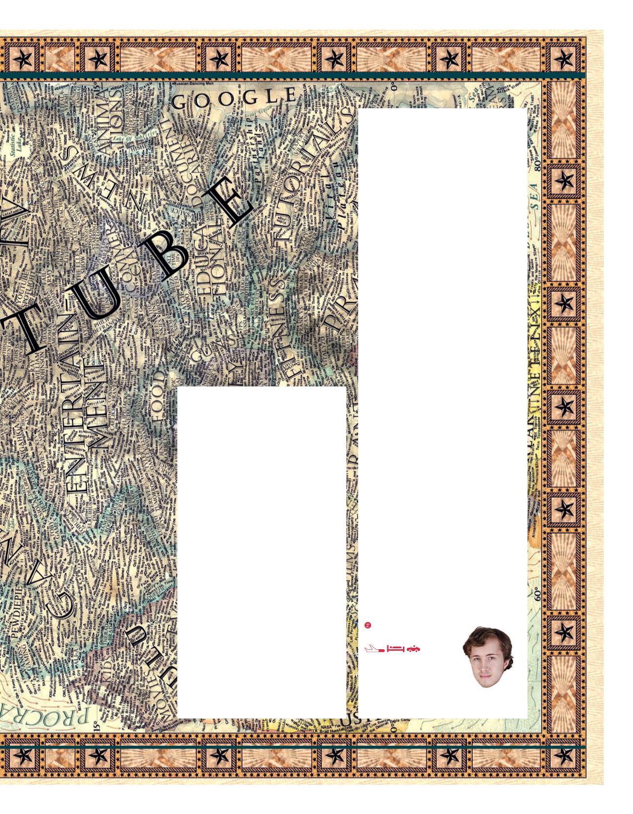
N
orthof theDigital
Ocean lies the great
continent of Apple, next
towhich sits the island
of Blackberry. To the
west, over theOceanof Information,
is the country ofGoogle; and to the
south, bordering the shoreof Internet
Crime, is the SpamOcean.
This is the internet as imaginedby
17-year-oldSlovakiangraphicdesigner
MartinVargic,who spent threeweeks
creating the intricatelydetailed vintage-
stylemap thatwent viral last year after
being featuredonGizmodo. Basedon
its success, hehas recentlycompiled
64of hismaps into
Vargic’sMiscellanyof
CuriousMaps–TheAtlasofEverything
YouNeverKnewYouNeeded toKnow
, a
coffee-tablebookpublishedbyPenguin.
Thefirstmajormap that Vargicever
drewwas of theBritish Isles in2012
whenhewas just 14. But, itwasn’t the
British Isles aswe know it. Itwas a
fictionalmapof the landmass as Vargic
imagined it in the year 2100, with sea
levels 80mhigher than they are today.


